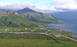
Aleutian Islands Census Area
Aleutian Islands Census Area er et tidligere statistikkområde i den amerikanske delstaten Alaska. I 1960 hadde området et areal på 40 147,4 kvadratkilometer,[1] og omfattet landområdene på den vestlige halvdelen av Alaskahalvøya og øygruppene Aleutene og Pribilof.


Ved folketellingen i 1980 ble landområdene som ligger mellom Cape Kumnik i øst og Kupreanof Point i vest overført til statistikkområdet Dillingham, og Aleutian Islands areal ble redusert til 28 205 kvadratkilometer.[2]
Den 23. oktober 1987 ble Aleutian Islands delt opp i bykommunen Aleutians East og statistikkområdet Aleutians West.[3]
Befolkningsutvikling
rediger| Folketellingsår | 1960 | 1970 | 1980 |
| Innbyggertall | 6 011 | 8 057 | 7 768 |
- I 1960: Aleutian Islands Election District (valgdistrikt #14). I 1970: Aleutian Islands Census Division.
Referanser
rediger- ^ Bureau of the Census, Census of Population, 1960: Total Population Counts for the U.S., States.... Washington D.C., 1961. Alaska, Table 6.-«Area and population of election districts, urban and rural: 1960».
- ^ Bureau of the Census, County and City Data book 1988. U.S. Government Printing Office, 1988. Side 29.
- ^ The Newberry Library: Alaska Atlas of Historical County Boundaries Arkivert 11. oktober 2014 hos Wayback Machine.. Individual County Chronologies. Besøkt 17. september 2014. (en)
Kilder
rediger- U.S. Bureau of the Census, Population of States and Counties of the United States: 1790 to 1990. From the Twenty-one Decennial Censuses. Mars 1996. (Del III side 11-12) (en)
- Kartdata fra The Newberry Library: Alaska Atlas of Historical County Boundaries Arkivert 11. oktober 2014 hos Wayback Machine.. Interactive Map. (en)
Autoritetsdata