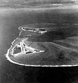
Fil:Aerial view of Midway Atoll on 24 November 1941 (80-G-451086).jpg

Størrelse på denne forhåndsvisningen: 562 × 599 piksler. Andre oppløsninger: 225 × 240 piksler | 450 × 480 piksler | 720 × 768 piksler | 961 × 1 024 piksler | 1 921 × 2 048 piksler | 4 500 × 4 797 piksler.
Opprinnelig fil (4 500 × 4 797 piksler, filstørrelse: 5,11 MB, MIME-type: image/jpeg)
Filhistorikk
Klikk på et tidspunkt for å vise filen slik den var på det tidspunktet.
| Dato/klokkeslett | Miniatyrbilde | Dimensjoner | Bruker | Kommentar | |
|---|---|---|---|---|---|
| nåværende | 18. jan. 2015 kl. 22:49 |  | 4 500 × 4 797 (5,11 MB) | Cobatfor | new NHHC file |
| 8. jul. 2006 kl. 21:18 |  | 658 × 619 (110 KB) | Sebmol | Caption: Midway Atoll. Aerial photograph, looking just south of west across the southern side of the atoll, 24 November 1941. Eastern Island, then the site of Midway's airfield, is in the foreground. Sand Island, location of most other base facilitie |
Filbruk
Den følgende siden bruker denne filen:
Global filbruk
Følgende andre wikier bruker denne filen:
- Bruk i ang.wiki.x.io
- Bruk i ar.wiki.x.io
- Bruk i ast.wiki.x.io
- Bruk i azb.wiki.x.io
- Bruk i bg.wiki.x.io
- Bruk i bh.wiki.x.io
- Bruk i br.wiki.x.io
- Bruk i bs.wiki.x.io
- Bruk i ca.wiki.x.io
- Bruk i cs.wiki.x.io
- Bruk i da.wiki.x.io
- Bruk i de.wiki.x.io
- Bruk i en.wiki.x.io
- Midway Atoll
- Battle of Midway
- Wikipedia:Selected anniversaries/June 4
- User:Palm dogg/Images
- Portal:United States/Anniversaries/June
- Portal:United States/Anniversaries/All
- First Bombardment of Midway
- Portal:United States/Anniversaries/June/June 4
- List of Medal of Honor recipients for the Attack on Pearl Harbor
- User:Jememcak/sandbox
- VMSB-343
- Bruk i eo.wiki.x.io
- Bruk i es.wiki.x.io
- Bruk i et.wiki.x.io
- Bruk i fa.wiki.x.io
- Bruk i fi.wiki.x.io
- Bruk i fr.wiki.x.io
- Bruk i fy.wiki.x.io
- Bruk i ga.wiki.x.io
- Bruk i gl.wiki.x.io
- Bruk i he.wiki.x.io
- Bruk i id.wiki.x.io
- Bruk i it.wiki.x.io
- Bruk i ja.wiki.x.io
- Bruk i ko.wiki.x.io
- Bruk i ky.wiki.x.io
Vis mer global bruk av denne filen.


