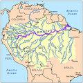
Fil:Amazonrivermap.png

Størrelse på denne forhåndsvisningen: 600 × 600 piksler. Andre oppløsninger: 240 × 240 piksler | 480 × 480 piksler | 1 000 × 1 000 piksler.
Opprinnelig fil (1 000 × 1 000 piksler, filstørrelse: 551 KB, MIME-type: image/png)
Filhistorikk
Klikk på et tidspunkt for å vise filen slik den var på det tidspunktet.
| Dato/klokkeslett | Miniatyrbilde | Dimensjoner | Bruker | Kommentar | |
|---|---|---|---|---|---|
| nåværende | 19. des. 2022 kl. 20:02 |  | 1 000 × 1 000 (551 KB) | Italyoz484 | |
| 1. sep. 2022 kl. 18:04 |  | 1 000 × 1 000 (583 KB) | Wolf170278 | Tocantins doesn't belong to the amazon river basin | |
| 8. sep. 2008 kl. 18:15 |  | 1 000 × 1 000 (551 KB) | Kmusser | {{Information |Description=This is a map of the Amazon River drainage basin with the Amazon River highlighted. |Source=Own work using http://www.maproom.psu.edu/dcw/ Digital Chart of the World and [[http://edc.usgs.gov/products/el |
Filbruk
De følgende 2 sidene bruker denne filen:
Global filbruk
Følgende andre wikier bruker denne filen:
- Bruk i da.wiki.x.io
- Bruk i de.wiki.x.io
- Bruk i de.wikinews.org
- Bruk i en.wiki.x.io
- Bruk i es.wikibooks.org
- Bruk i he.wiki.x.io
- Bruk i ko.wiki.x.io
- Bruk i lez.wiki.x.io
- Bruk i nn.wiki.x.io

