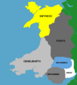
Fil:CymruMap.PNG
CymruMap.PNG (514 × 566 piksler, filstørrelse: 11 KB, MIME-type: image/png)
Filhistorikk
Klikk på et tidspunkt for å vise filen slik den var på det tidspunktet.
| Dato/klokkeslett | Miniatyrbilde | Dimensjoner | Bruker | Kommentar | |
|---|---|---|---|---|---|
| nåværende | 28. des. 2005 kl. 15:46 |  | 514 × 566 (11 KB) | Rhion | Mao o deynrnasoedd Cymru yn y Canol Oesoedd Map of Mediaeval kingdoms of Wales Rhion Pritchard |
Filbruk
De følgende 2 sidene bruker denne filen:
Global filbruk
Følgende andre wikier bruker denne filen:
- Bruk i af.wiki.x.io
- Bruk i an.wiki.x.io
- Bruk i ast.wiki.x.io
- Bruk i bn.wiki.x.io
- Bruk i br.wiki.x.io
- Bruk i ca.wiki.x.io
- Bruk i cs.wiki.x.io
- Bruk i cy.wiki.x.io
- Bruk i dsb.wiki.x.io
- Bruk i en.wiki.x.io
- Bruk i es.wiki.x.io
- Bruk i eu.wiki.x.io
- Bruk i fr.wiki.x.io
- Bruk i ga.wiki.x.io
- Bruk i gl.wiki.x.io
- Bruk i hu.wiki.x.io
- Bruk i is.wiki.x.io
- Bruk i it.wiki.x.io
Vis mer global bruk av denne filen.

