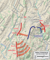
Fil:Gettysburg Day2 Plan.png

Størrelse på denne forhåndsvisningen: 501 × 599 piksler. Andre oppløsninger: 201 × 240 piksler | 401 × 480 piksler | 642 × 768 piksler | 857 × 1 024 piksler | 1 713 × 2 048 piksler | 4 950 × 5 917 piksler.
Opprinnelig fil (4 950 × 5 917 piksler, filstørrelse: 18,74 MB, MIME-type: image/png)
Filhistorikk
Klikk på et tidspunkt for å vise filen slik den var på det tidspunktet.
| Dato/klokkeslett | Miniatyrbilde | Dimensjoner | Bruker | Kommentar | |
|---|---|---|---|---|---|
| nåværende | 1. jan. 2023 kl. 23:05 |  | 4 950 × 5 917 (18,74 MB) | Hlj | Oops, uploaded wrong file |
| 1. jan. 2023 kl. 22:48 |  | 4 950 × 5 917 (18,7 MB) | Hlj | improved graphics | |
| 12. aug. 2011 kl. 22:46 |  | 2 672 × 3 875 (2,24 MB) | Hlj | Improve topography, legend. Same license. | |
| 2. apr. 2011 kl. 20:54 |  | 1 629 × 2 461 (1,25 MB) | Hlj | Updated graphical format of rivers and roads. Same license. | |
| 20. jul. 2010 kl. 18:09 |  | 1 629 × 2 461 (1,05 MB) | Hlj | Adjust graphics for more recent ACW map styling, legend, and scale. {{cc-by-3.0|Map by Hal Jespersen, www.posix.com/CW}} | |
| 11. nov. 2006 kl. 19:09 |  | 1 547 × 2 346 (1,01 MB) | Rheo1905~commonswiki | this map made by en:User:Hlj. Map of actions in the Battle of Gettysburg, second day, Lee's plan. Drawn by Hal Jespersen in Macromedia Freehand. Graphic source file is available at http://www.posix.com/CWmaps/ {{PD-release}} |
Filbruk
Den følgende siden bruker denne filen:
Global filbruk
Følgende andre wikier bruker denne filen:
- Bruk i bg.wiki.x.io
- Bruk i ca.wiki.x.io
- Bruk i da.wiki.x.io
- Bruk i en.wiki.x.io
- Bruk i es.wiki.x.io
- Bruk i fr.wiki.x.io
- Bruk i he.wiki.x.io
- Bruk i hu.wiki.x.io
- Bruk i kn.wiki.x.io
- Bruk i ko.wiki.x.io
- Bruk i pt.wiki.x.io
- Bruk i ro.wiki.x.io
- Bruk i zh.wiki.x.io