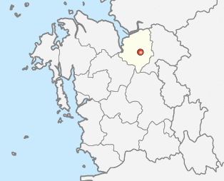
Fil:Map Asan-si.png
Map_Asan-si.png (314 × 254 piksler, filstørrelse: 31 KB, MIME-type: image/png)
Filhistorikk
Klikk på et tidspunkt for å vise filen slik den var på det tidspunktet.
| Dato/klokkeslett | Miniatyrbilde | Dimensjoner | Bruker | Kommentar | |
|---|---|---|---|---|---|
| nåværende | 2. jun. 2012 kl. 18:15 |  | 314 × 254 (31 KB) | Geoarchive | Update establishment of Sejong Special Autonomous City, Relocate location of Asan-Si office, Change into more accurate lines of administrative district |
| 25. jun. 2011 kl. 02:01 |  | 300 × 258 (6 KB) | Asfreeas | color and form match | |
| 23. des. 2004 kl. 18:18 |  | 301 × 258 (5 KB) | Visviva | {{GFDL}}Made from Maps of Korea. |
Filbruk
Den følgende siden bruker denne filen:
Global filbruk
Følgende andre wikier bruker denne filen:
- Bruk i en.wiki.x.io
- Bruk i fa.wiki.x.io
- Bruk i fi.wiki.x.io
- Bruk i fr.wiki.x.io
- Bruk i it.wiki.x.io
- Bruk i ja.wiki.x.io
- Bruk i ko.wiki.x.io
- Bruk i sv.wiki.x.io
- Bruk i vi.wiki.x.io
- Bruk i zh-yue.wiki.x.io

